blah blah blah
Mt. Randolph
Length: 5.0 miles out-and-backDifficulty (click for info): Moderate
Elevation Gain: 1350 feet (+190 feet on return)
Rating (click for info): 7/10
Elevation: 3081'
Prominence: 177'
Driving Directions:
Trailhead is on Randolph Hill Road in Randolph, NH. From the top of the hill on Rt. 2, 3.5 miles west of the western junction with Rt. 16 in Gorham and 9.0 miles east of the junction with Rt. 115, turn north onto Randolph Hill Road. Drive for a total of 1.9 miles, around a 90-degree turn to the left, to a point where there is a sign for Cook Path on the right and a grassy old road descending to the left. Park on the shoulder. Click here for a Google map.
About the Hike:
Forming the south tail of the great arc of the Crescent Range is Mt. Randolph, which shares its name with both the club that maintains its intricate trail network and the town in which it resides. Its forested summit is seldom visited, with famous Lookout Ledge garnering most of the attention this range of the White Mountains receives. The dramatic precipice is treasured for its premiere view of Mt. Adams and King Ravine. As Lookout is situated on the southern slopes of Mt. Randolph, it is a stop on the way to the summit. If you have extra time after experiencing Lookout Ledge, the summit of Randolph is a worthwhile visit not too far away. Recent trail work by the RMC has greatly improved the view from the top, and it now offers a secluded forest view across the valley toward Mt. Crescent.
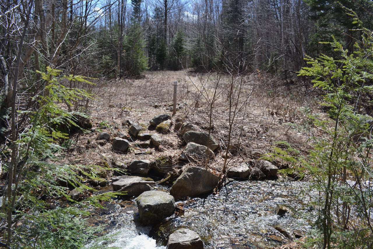
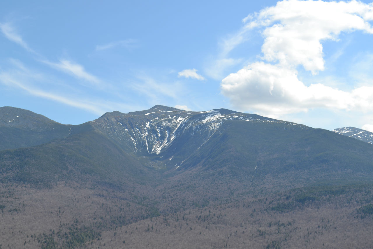
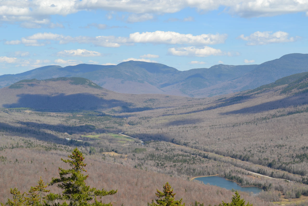
From your starting point, walk a little over a tenth of a mile downhill on a shortcut called Grassy Lane. Turn right as you tee into Pasture Path, which parallels Randolph Hill Road. Set off in a narrow corridor through level forest, passing over an occasional bog bridge or two. Stroll along with little elevation change for just over a half mile to a trail junction. Take a left to stay on Pasture Path, following an old road as Four Soldiers Path continues ahead, then in 200 feet, turn right, again staying on Pasture Path. The trail soon crosses Carlton Brook, followed by two of its tributaries, in the next quarter mile. The brooks drain the south side of the Crescent Ridge. In higher water, it can be harder to make use of the stepping stones, so use caution. At the last brook, the trail crosses Jimtown logging road at an angle and sneaks by the right side of a clearing where it ends. The climb begins in earnest now, as the trail ascends moderately through open hardwoods. In 0.4 miles, Ledge Trail merges from the left; continue up for 0.2 miles over a final bout of the steepest terrain, where the trail becomes rockier through dark evergreens. Reaching a trail junction above the ledge where the path ahead becomes Crescent Ridge Trail, follow a path a few steps downhill to the left to reach the top of the outlook, where a sign on a lone tree identifies your location as Lookout Ledge. Here you are greeted with a grand sweep of a vista across the Israel River valley, bisected by Rt. 2. Mt. Adams looms ahead, flanked by Mt. Madison on its left and Mt. Jefferson on its right. A closer look reveals the scalloped talus slopes of the headwall and the piles at the base. Durand Lake shimmers beneath you to the left. The low, cliffy rise of Pine Mountain intrudes into the valley further to the left, with Middle Carter and the three Moriahs as a backdrop. Furthest over to the left, the view stretches into Maine past the southern reaches of the Mahoosuc Range.
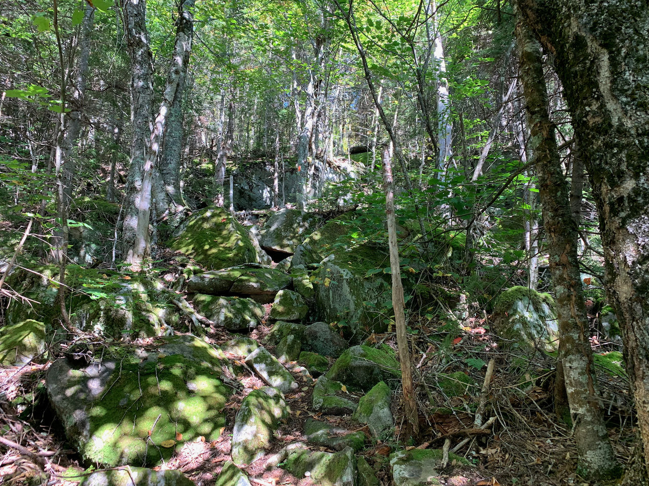
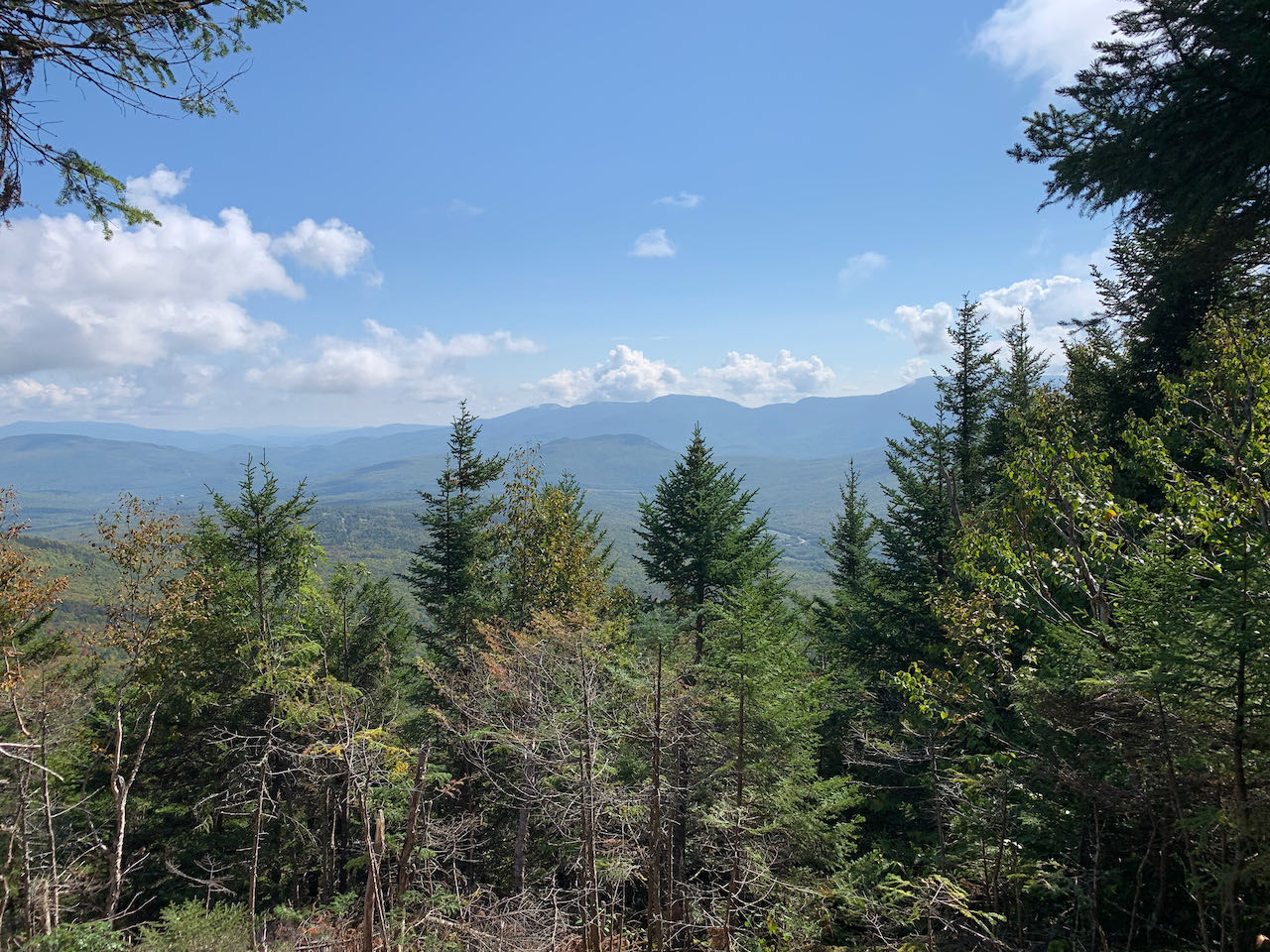
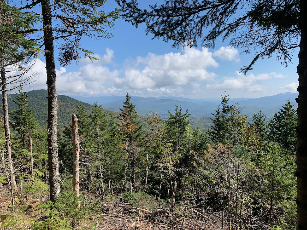
Head back up to the Crescent Ridge Trail and continue through a slot in between boulders onto a level forest path. In 0.15 miles, take a right to stay on the Crescent Ridge Trail as Sargent Path continues straight. The trail meanders gently through the bright, verdant forest, cutting a corridor through the ferns. In a quarter mile, Four Soldiers Path crosses perpendicular. Continue straight. The grade soon steepens, and the trail negotiates a few sharp pitches through a salad of boulders. A brief interlude of more ferns and birch trees follows. One more brief scramble up a boulder chute leads to a ledge ramp with a view back toward Adams and Madison, a total of 0.4 miles from the last trail junction. The view is from a higher perspective, although it is much less open than what you saw from Lookout Ledge. Just a bit further back into the forest, a sign on a tree amidst a dark conifer grove marks the summit of Mt. Randolph, although there is a higher peak half a mile to the north on the ridge which could properly be called the summit. With nothing to see here, follow the trail about 200 feet beyond the high point down to where the trail crews have graciously cleared an opening facing east over the bowl forming by the curling Crescent Ridge. Over the treetops, you gaze across to the summit of Crescent, not far away, with the distant Mahoosuc Range beyond. A greater portion of it is visible now than was seen from Lookout Ledge, including the high peaks in Maine of Old Speck and Goose Eye. The view reaches a good distance across the Androscoggin River Valley into Maine. Over to the right, you can see back toward the Moriah group behind Pine Mountain.
Printable directions page